Moho Map
|
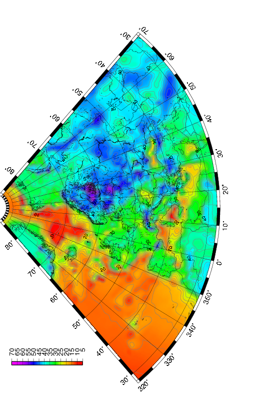
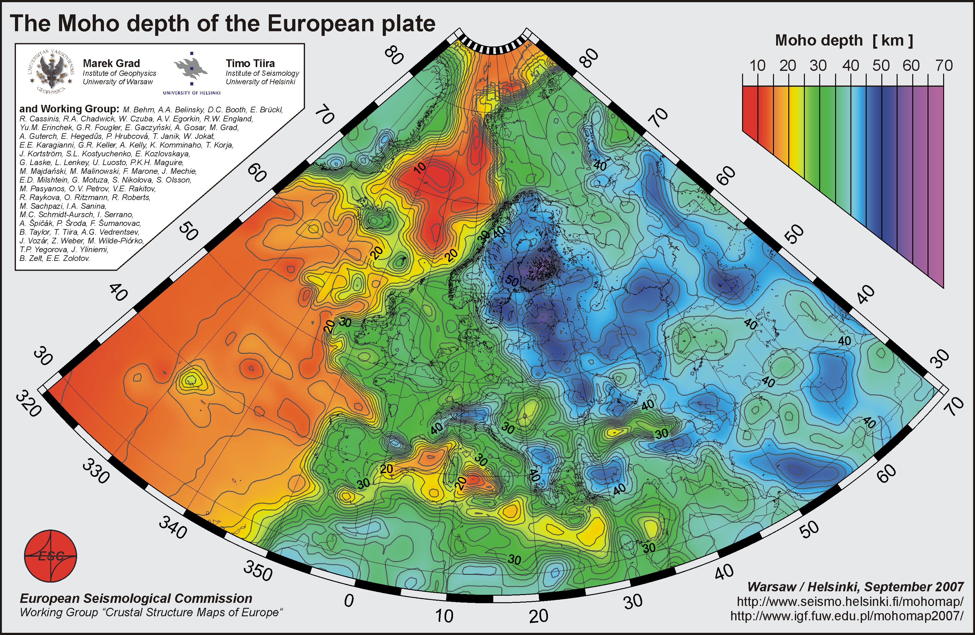
Summary The European plate has a 4.5 Gy long and complex tectonic history. This is reflected in the present day large scale structures. The new digital Moho depth map is compiled from more than 250 data sets of individual seismic profiles, 3D models obtained by body and surface waves, receiver function results, and maps of seismic and/or gravity data compilations. We have compiled the first digital, high resolution map of the Moho depth for the whole European plate extending from the Ural Mountains in the east to mid-Atlantic ridge in the west, and from the Mediterranean Sea in the south to the Barents Sea and Spitsbergen in Arctic in the north. In general three large domains within European plate crust are visible. The oldest Archean and Proterozoic crust has thickness 40-60 km, continental Variscan and Alpine crust has thickness 20-40 km, and the youngest oceanic Atlantic crust has thickness 10-20 km. An estimation of uncertainty has been computed for the area of the Moho map. # ESC Working Group comprises: M. Behm, A.A. Belinsky, D.C. Booth, E. Brückl, R. Cassinis, R.A. Chadwick, W. Czuba, A.V. Egorkin, R.W. England, Yu.M. Erinchek, G.R. Fougler, E. Gaczyński, A. Gosar, M. Grad, A. Guterch, E. Hegedűs, P. Hrubcová, T. Janik, W. Jokat, E.E. Karagianni, G.R. Keller, A. Kelly, K. Komminaho, T. Korja, J. Kortström, S.L. Kostyuchenko, E. Kozlovskaya, G. Laske, L. Lenkey, U. Luosto, P.K.H. Maguire, M. Majdański, M. Malinowski, F. Marone, J. Mechie, E.D. Milshtein, G. Motuza, S. Nikolova, S. Olsson, M. Pasyanos, O.V. Petrov, V.E. Rakitov, R. Raykova, O. Ritzmann, R. Roberts, M. Sachpazi, I.A. Sanina, M.C. Schmidt-Aursch, I. Serrano, A. Špičák, P. Środa, F. Šumanovac, B. Taylor, T. Tiira, A.G. Vedrentsev, J. Vozár, Z. Weber, M. Wilde-Piórko, T.P. Yegorova, J. Yliniemi, B. Zelt, E.E. Zolotov.
|

|
Page last modified on June 19, 2018, 12:06 p.m.